Two Land Use / Land Cover Sources Were Used for the Following Maps of CZO Study Sites
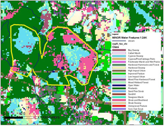
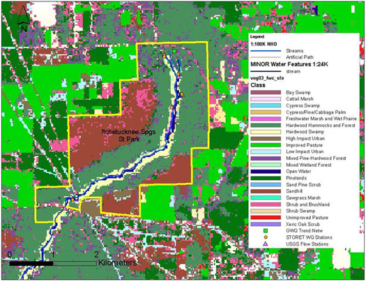
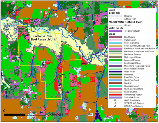
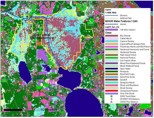
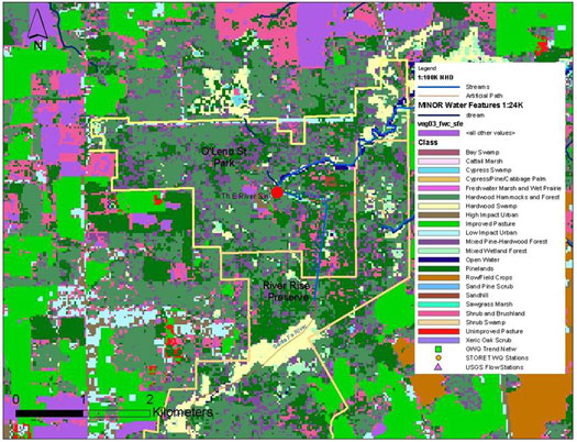
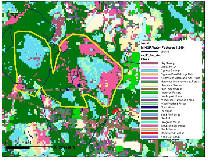
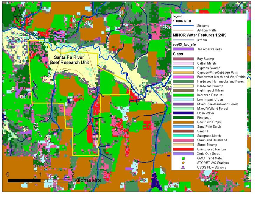
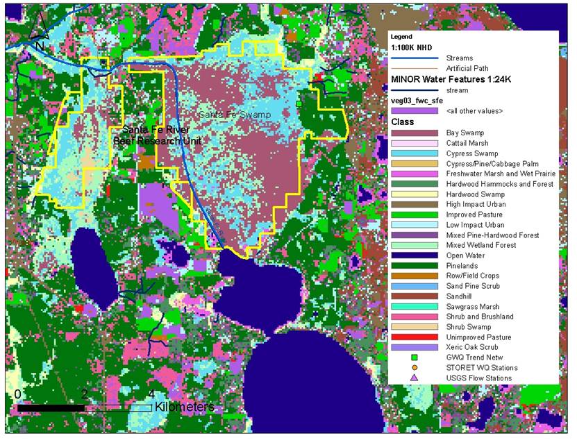
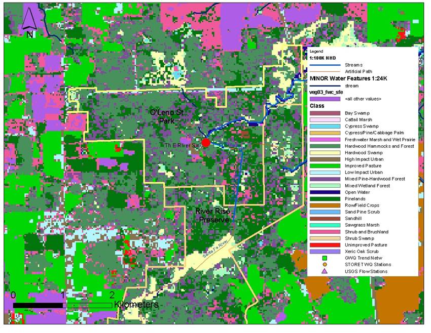
- The Veg03_FWC_sfe layer is a land cover layer developed by the Florida Fish and Wildlife Commission. This dataset contains plant community and landcover data. Normalized Difference Vegetation Index (NDVI) ratio bands were created for Landsat ETM scenes. The NDVI provided a measure of vegetation density that was used to aid in class discrimination. They mapped Landsat scenes using a series of iterative steps and ancillary data sets. Ancillary data sets included 1995 land use/land cover data created by Florida’s water management districts and the Florida Department of Environmental Protection, U. S. Fish and Wildlife Service National Wetlands Inventory (NWI) digital boundaries of Florida wetlands, detailed digital soils (SSURGO) data sets, the FWC 1985-89 land cover map (Kautz et al. 1993), and 1999 digital orthographic quarter quadrangle (DOQQ) aerial photography.
More information... (292KB pdf)
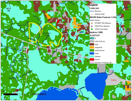
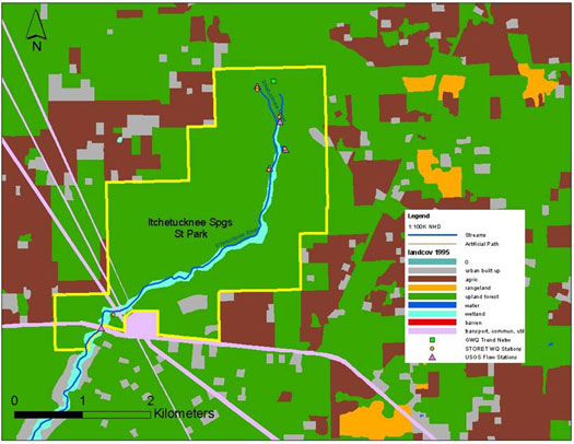
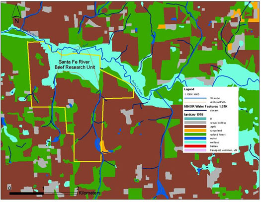
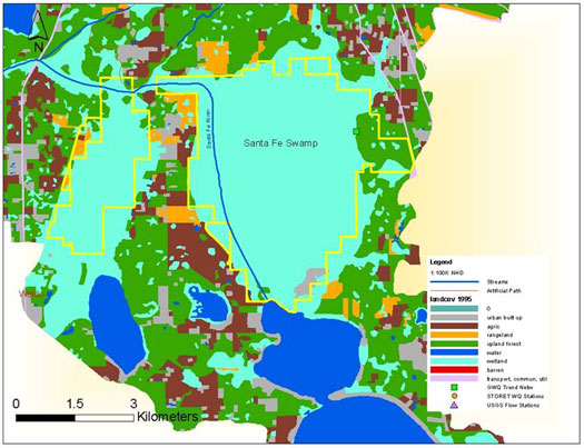
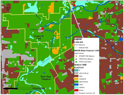
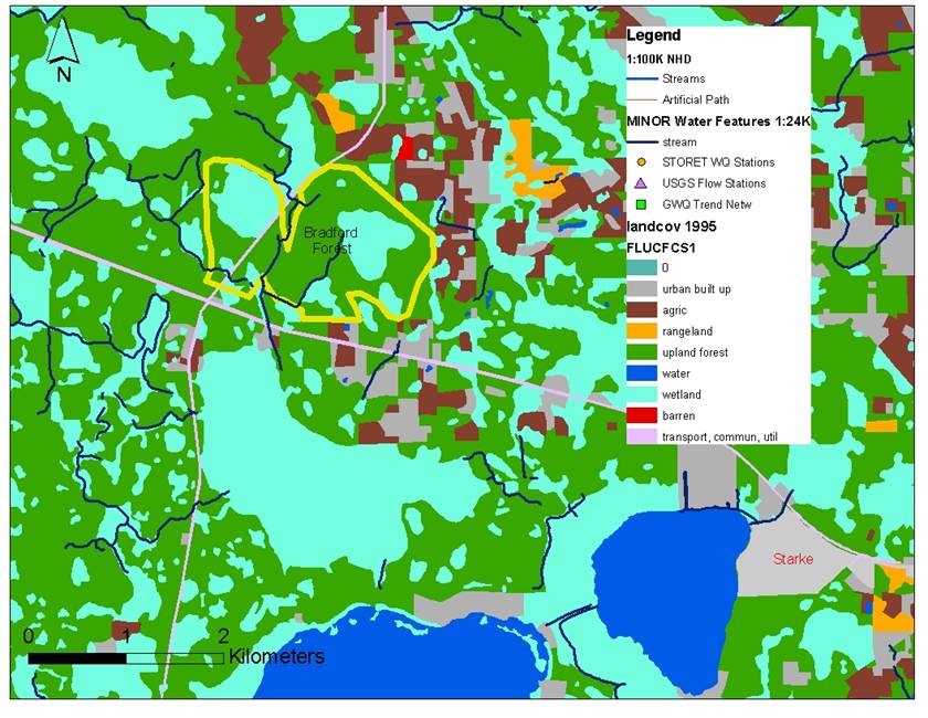
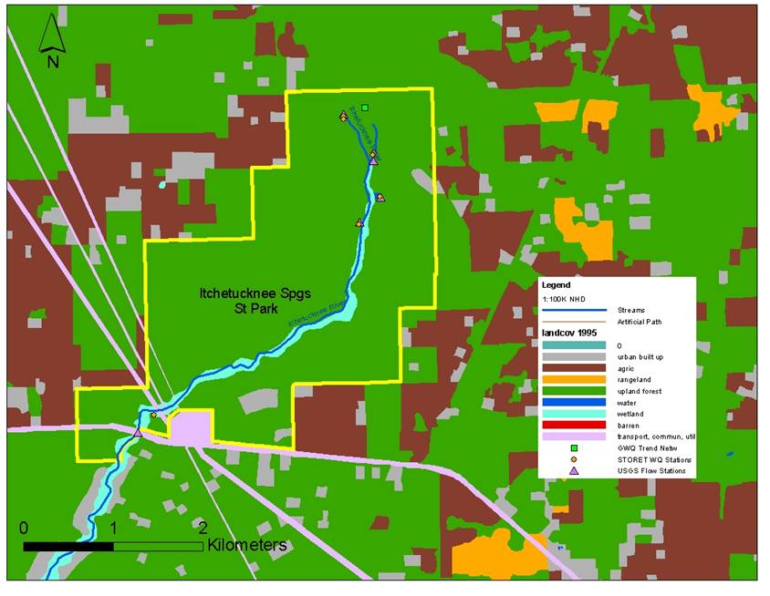
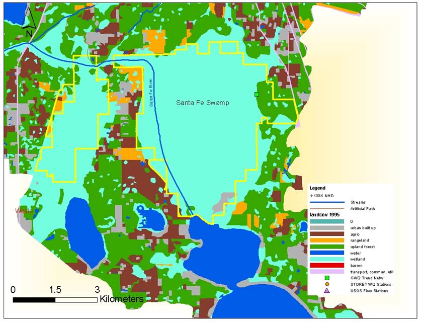
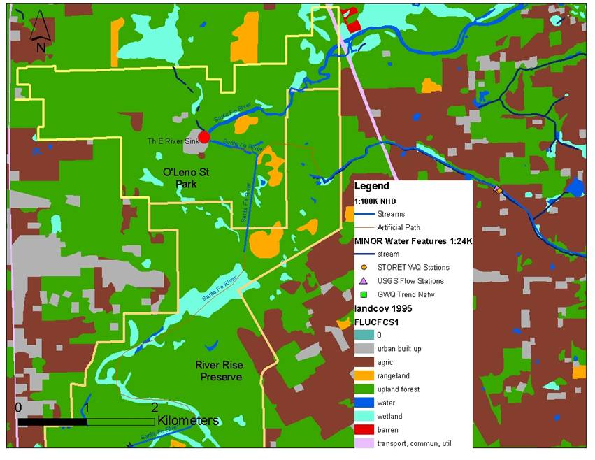
- The landcov 95 layer from 1995 was developed by the SRWMD. 1994-5 aerial color infrared photography was interprted on a USGS 7.5' quadrangle basis. The Land Use Cover and Forms Classification System (FLUCFCS), originally developed by the DOT, was followed. Kathleen merged classes of land use into more general classes (e.g. agriculture includes improved pasture) More information...