Base Layers and Information
Boundaries
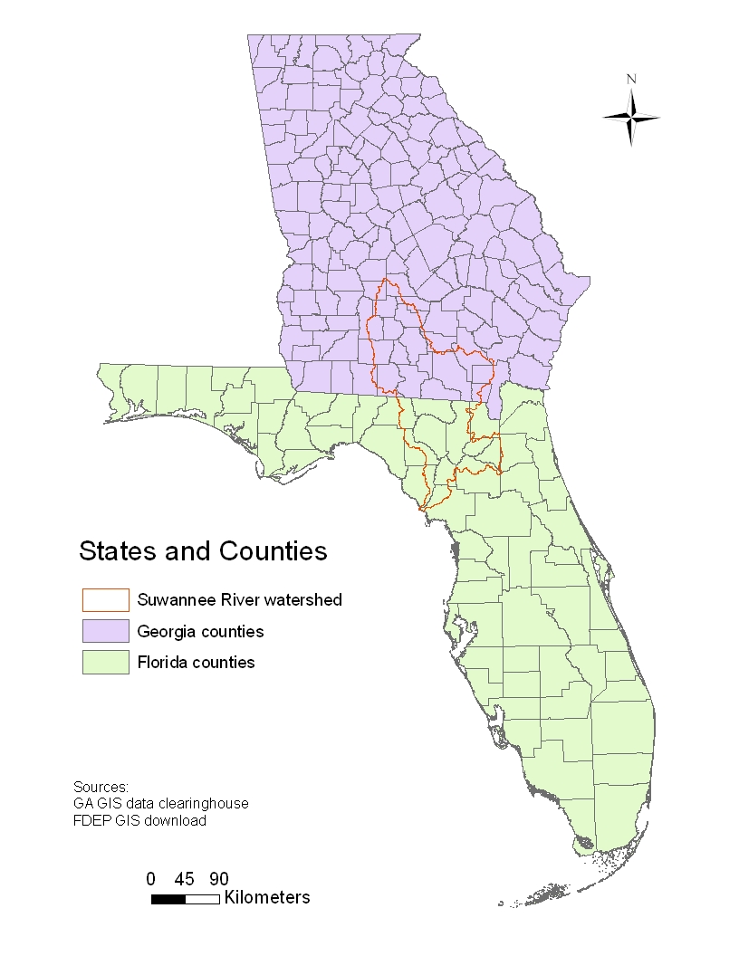
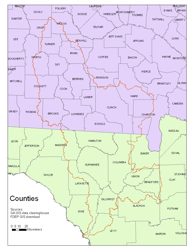
States & Counties |
|||
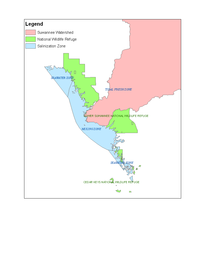
National Wildlife Refuge |
metadata |
||
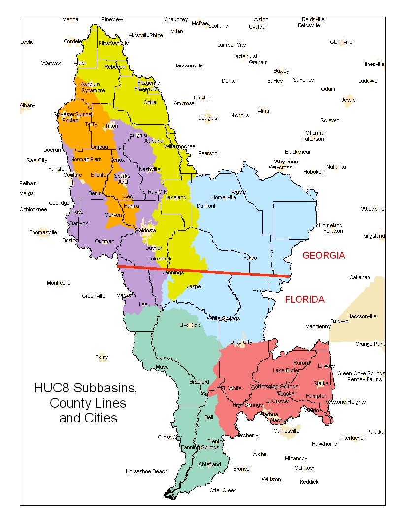
Cities |
metadata |
||
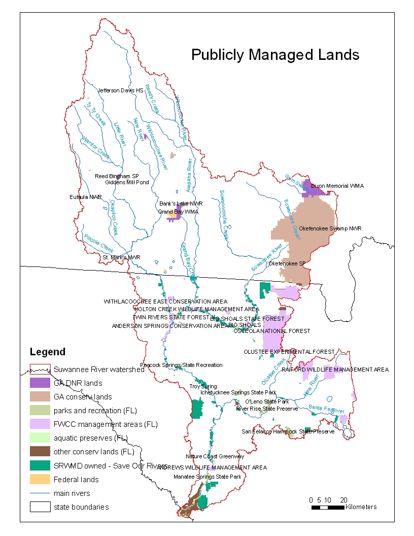
Publicly Managed Lands |
|||
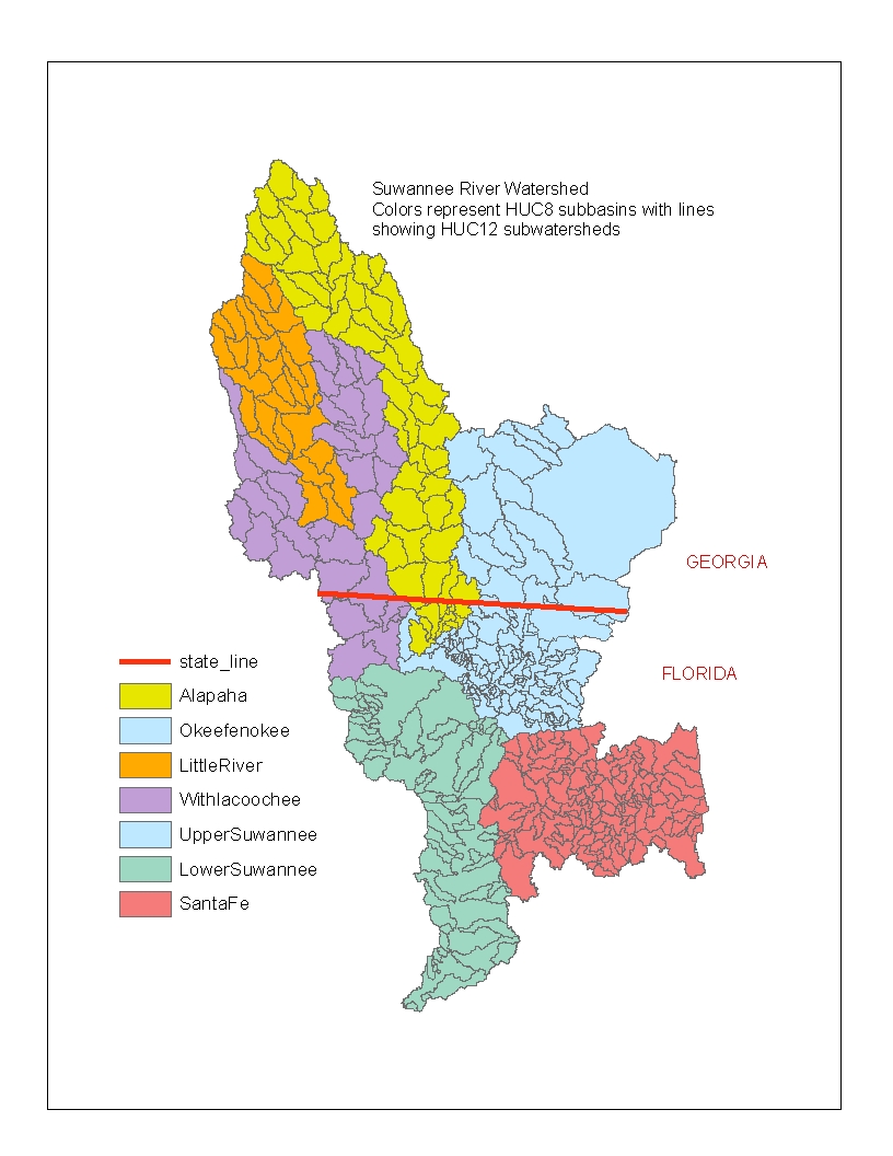
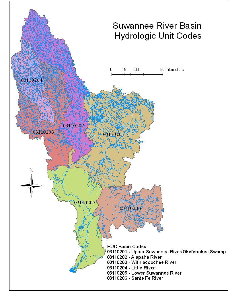
Basins HUC8, HUC12 and HUC codes |
Suwannee River Watershed - HUC8 and HUC12 subwatersheds (jpg) |
metadata |
|
| Springsheds |
Land Use/Cover
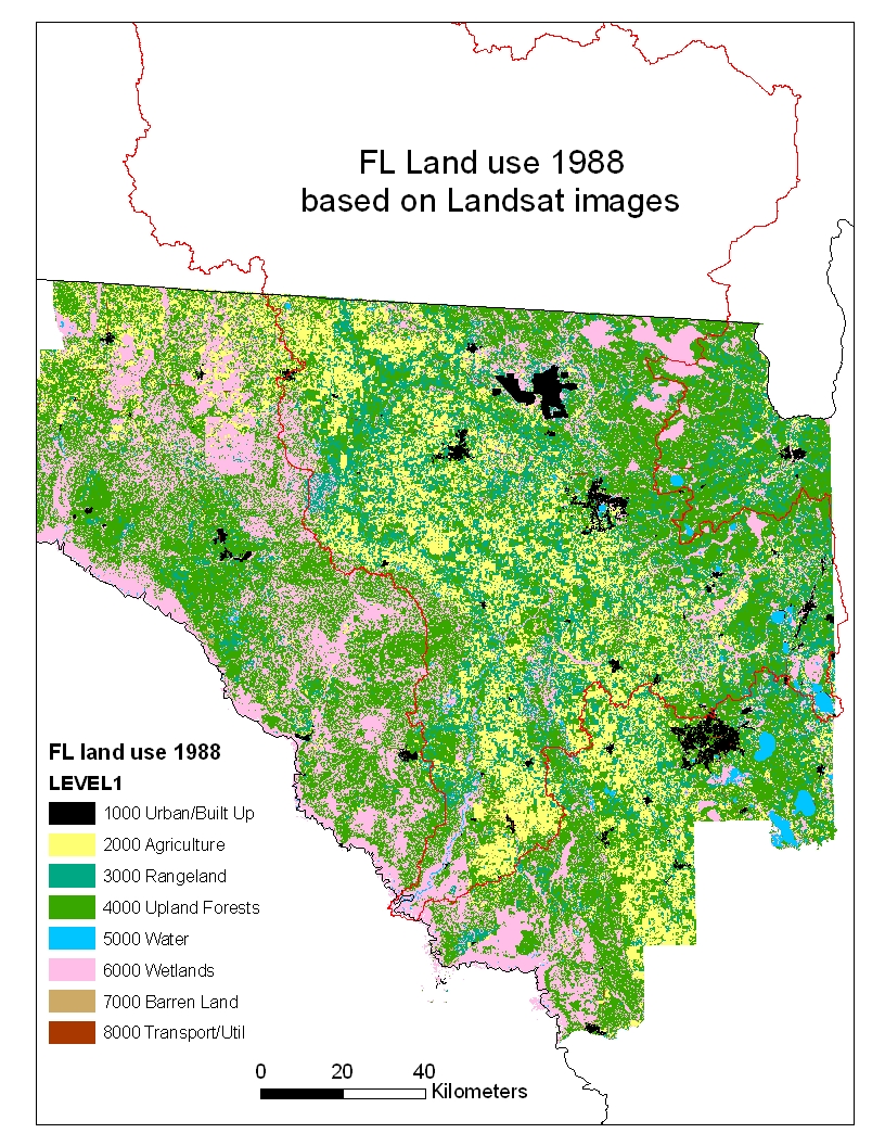
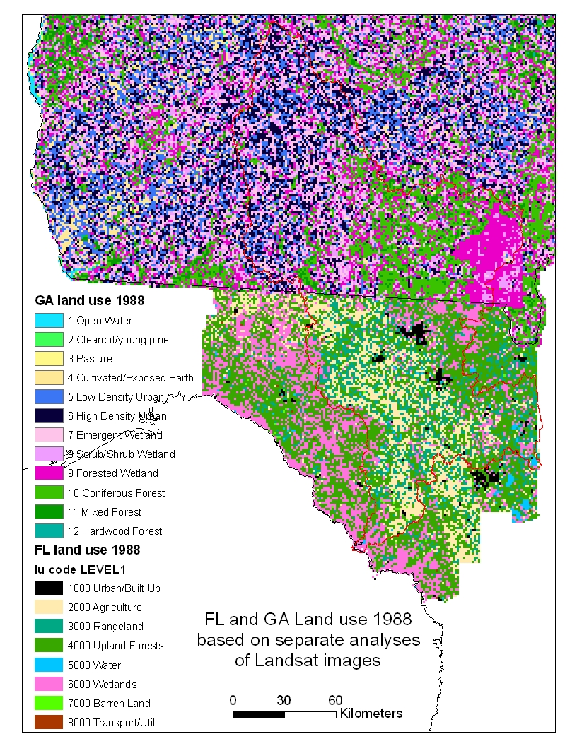
1988 Land cover (Florida) |
based on Landsat satellite |
|
||
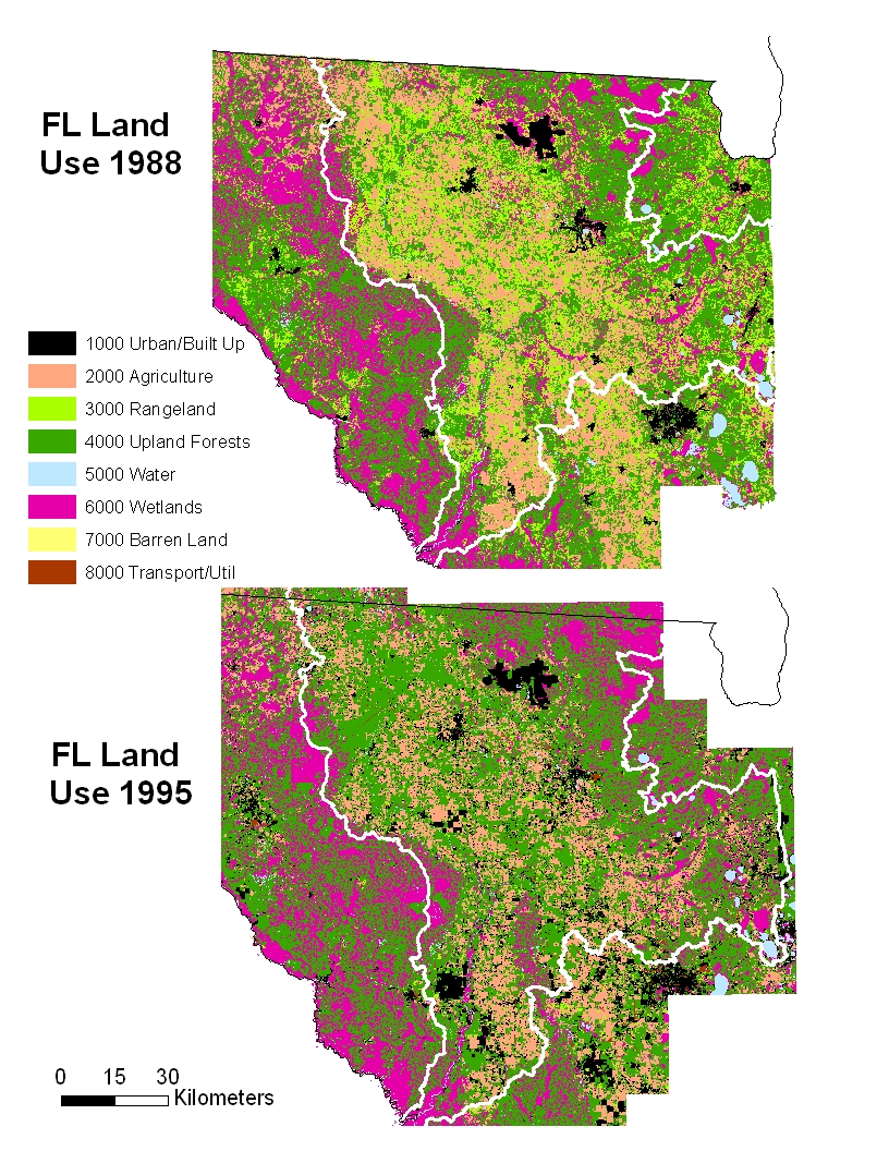
| 1995 Land Use (Florida) | based on 1:40,000 aerial photos | FL Land use 1988 and FL Land Use 1995 (jpg) | 95 metadata | |
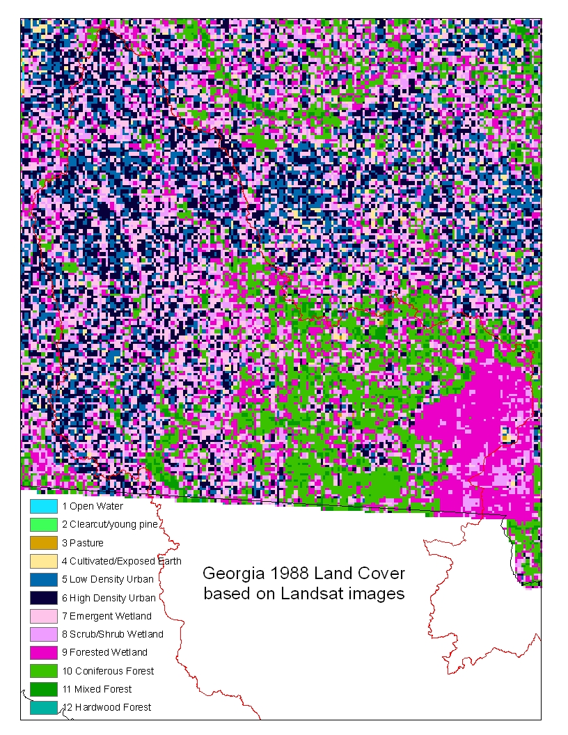
1988 Land Use (Georgia) |
based on Landsat satellite |
|||
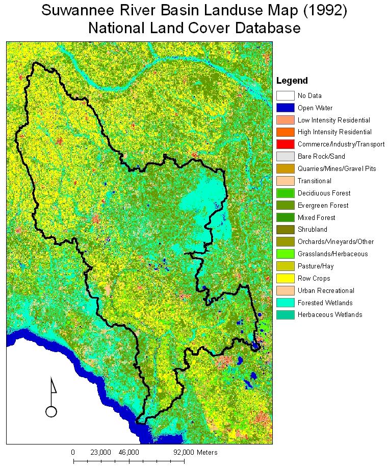
1992 National Land Cover (FL and GA) |
based on Landsat satellite |
Suwannee River Basin Landuse Map (1992) National Landcover Database (jpg) |
||
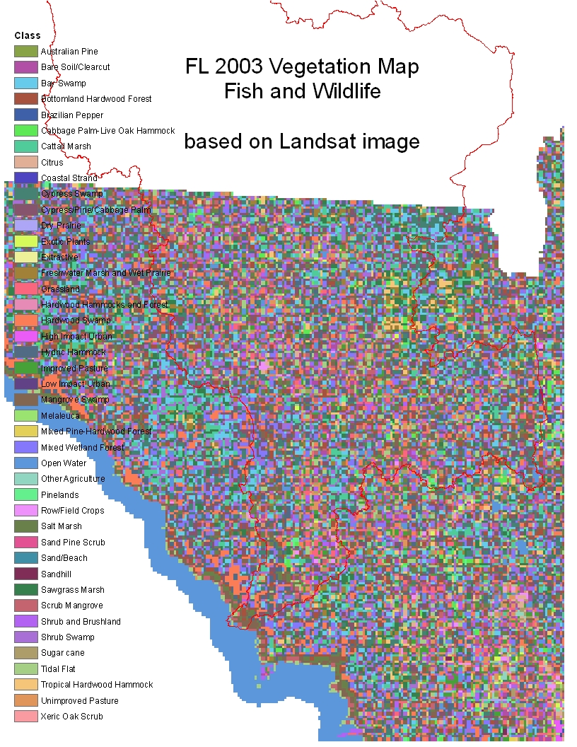
2003 Land Cover (Florida) |
based on satellite images; 17 natural and semi-natural land cover types, 4 land cover types indicative of human disturbance, and 1 water class |
|||
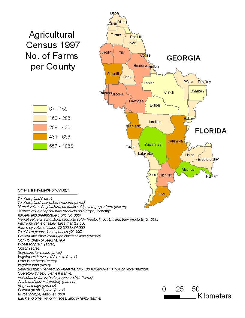
1997 Agricultural Census (FL and GA) |
Agriculture statistics per county |
|||
| 2002 and 1997 Agricultural Census (FL and GA) | Fertilizer and chemicals used per county | maps not available | ||
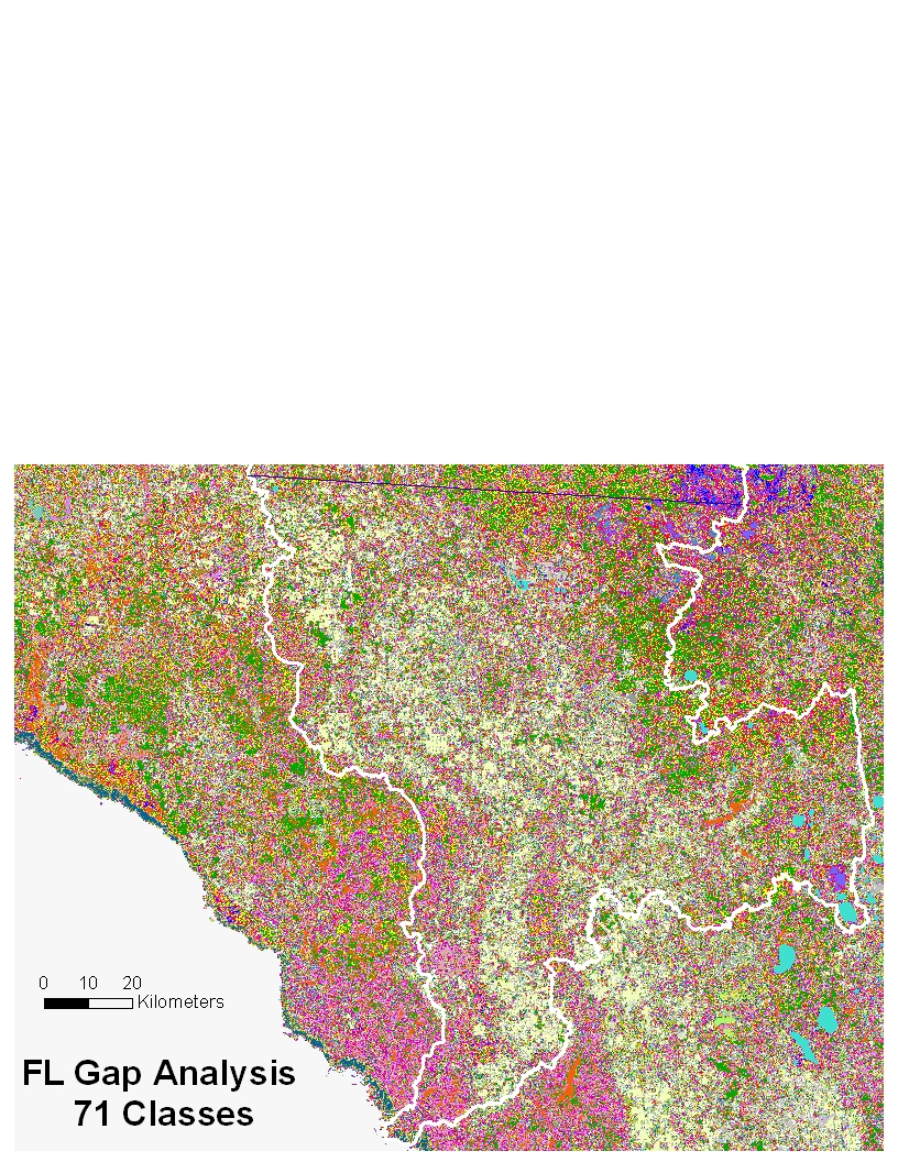
1994 GAP Analysis Natural Area Land Cover (Florida) |
Based on unsupervised classification of Tasseled Cap Landsat images after masking out urban areas. 71 classes with detailed wetland and forest types. |
FL Gap Analysis 71 Classes (jpg) | ||
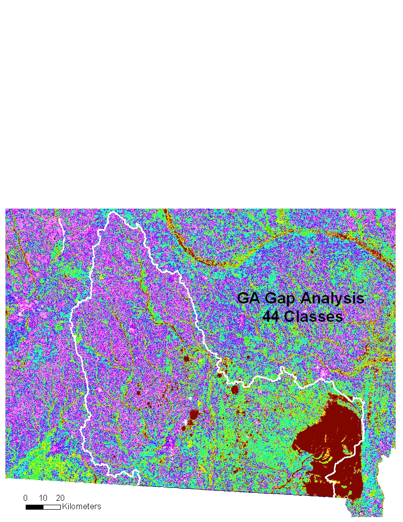
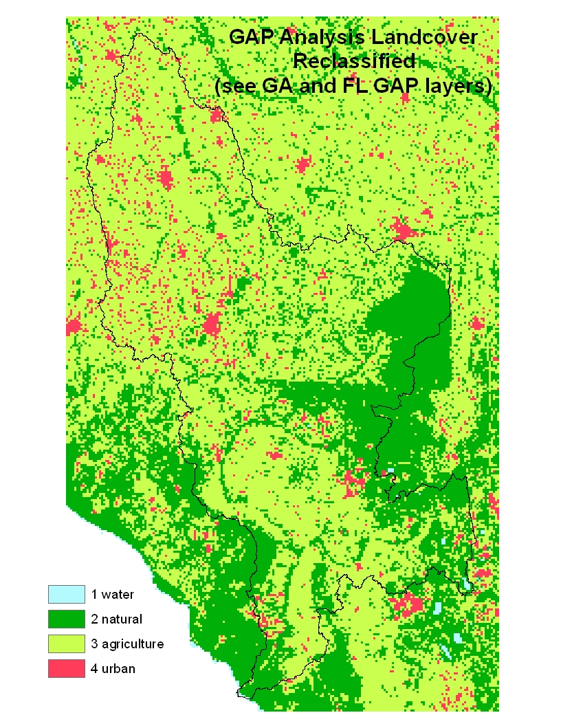
1998 GAP Analysis Natural Area Land Cover (Georgia) |
Created in two stages from Landsat imagery; 44 classes with detailed wetland and forest types. |
GA Gap Analysis 44 classes (jpg) | GAP Analysis Landcover Reclassified (jpg) | |
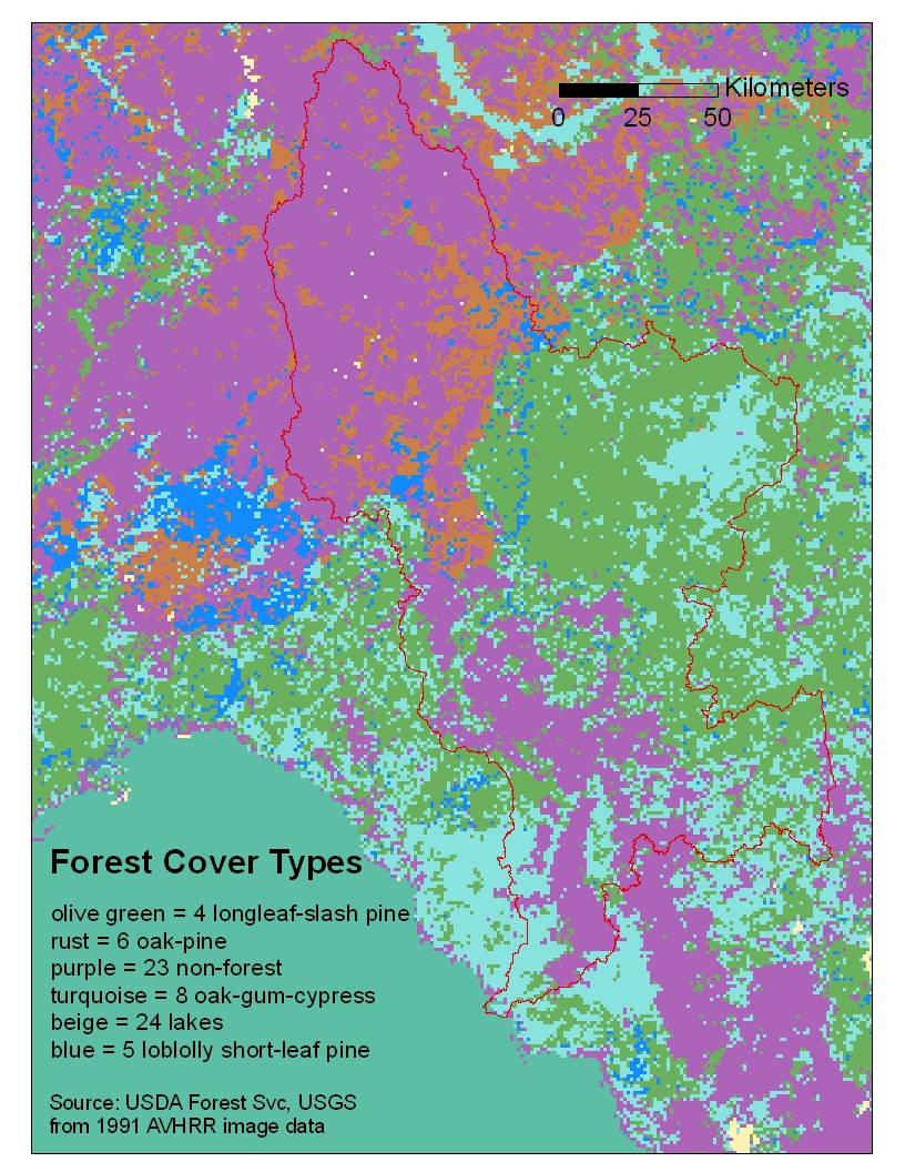
2001 Forest Cover Types (FL and GA) |
based on AVHRR imagery; 25 classes of forest cover types; 1:750,000 scale |
Infrastructure
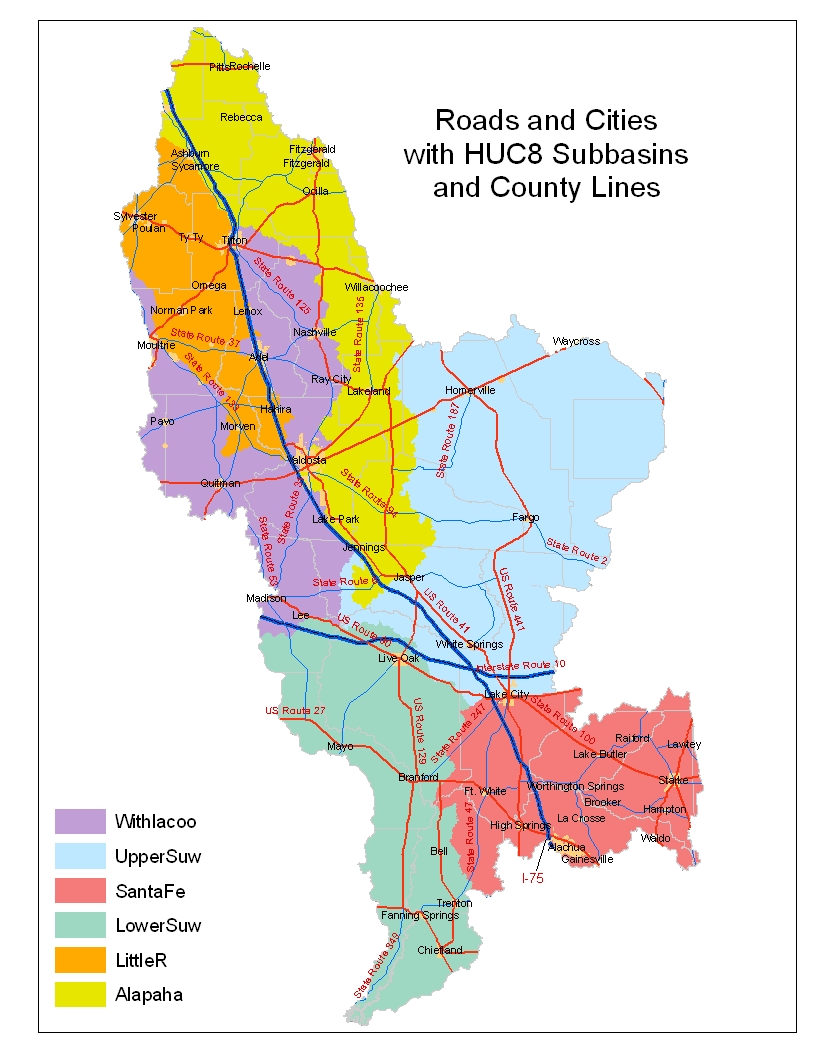
Major Roads / Cities |
metadata |
|||
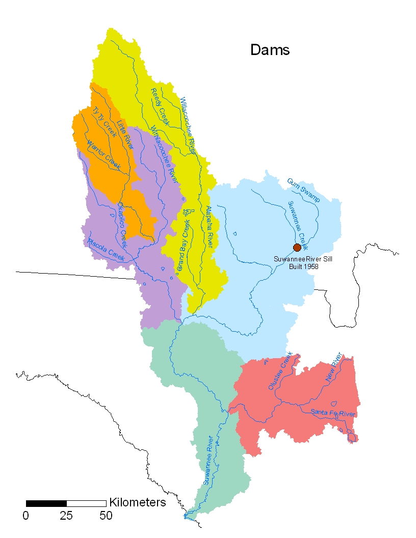
Dams |
Dams (jpg) |
Hydrography
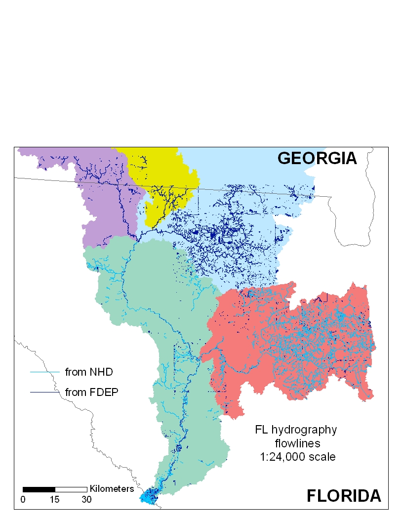
1:24,000 lines (Florida) |
|
FL Hydrography flowlines (jpg) | metadata | |
| 1:24,000 lines (Georgia) | Georgia Hydrography flowlines (jpg) | metadata | ||
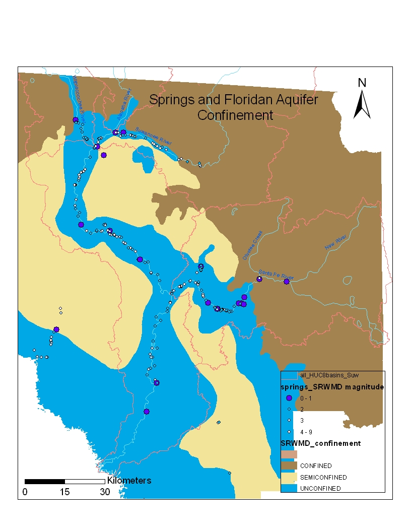
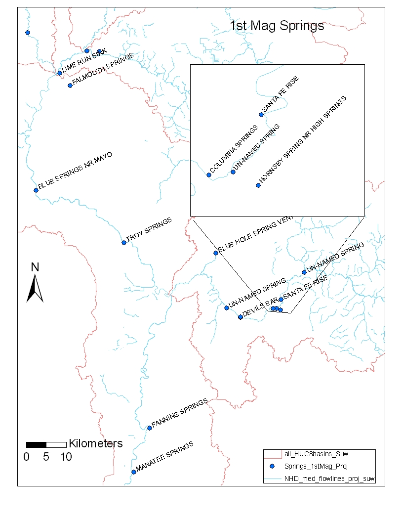
| springs | 17 1st mag springs in Suwannee | Springs and Floridian Aquifer Confinement (jpg) | 1st Mag Springs (jpg) | |
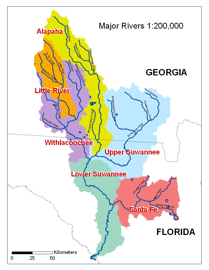
1:200,000 rivers |
from National Atlas |
metadata | ||
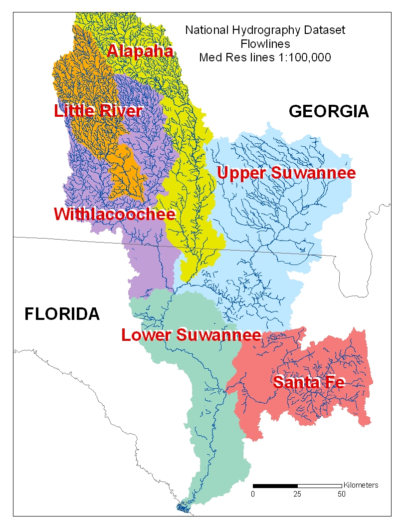
1:100,000 National Hydrography Dataset |
USGS digital line graphs and USEPA reaches plus points and areas |
National Hydrography Dataset Flowlines - Med Res lines 1:00,000 (jpg) | NHD fact sheet | |
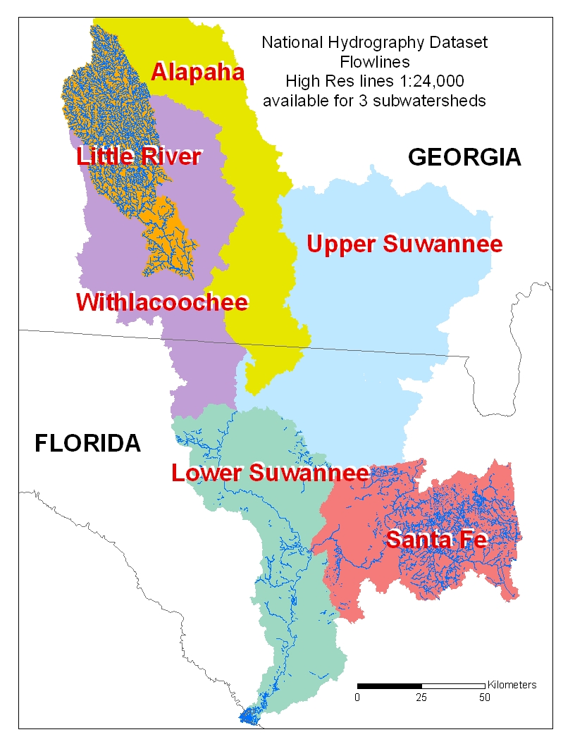
High Res National Hydrography Dataset |
for selected areas |
National Hydrography Dataset Flowlines - High Res lines 1:24,000 available for 3 subwatersheds (jpg) | NHD User Guide (739KB pdf) | |
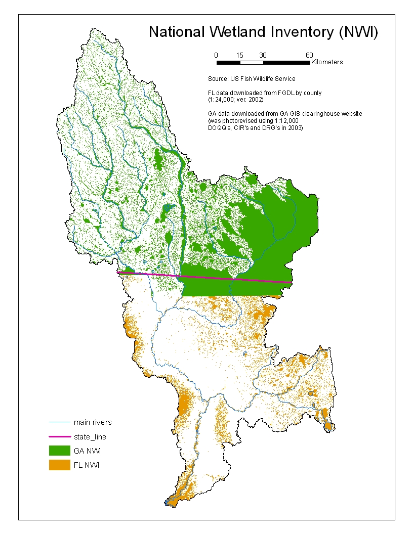
1:24,000 National Wetland Inventory (FL: 70's to early 90's) (GA: revised 2003) |
from US Fish and Wildlife |
National Wetland Inventory (jpg) |
Geology/Soils Topog
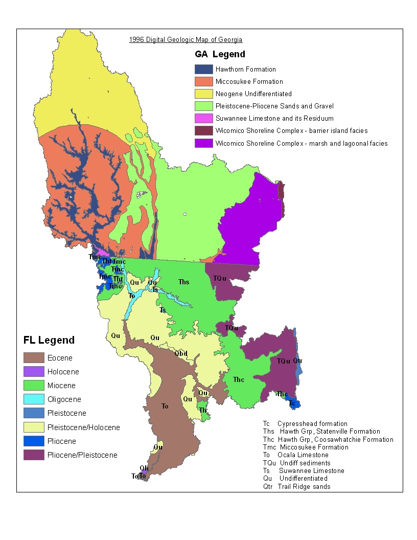
Geology Map |
from state governments |
|||
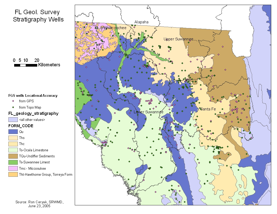
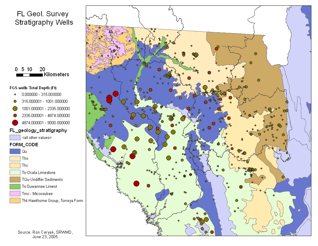
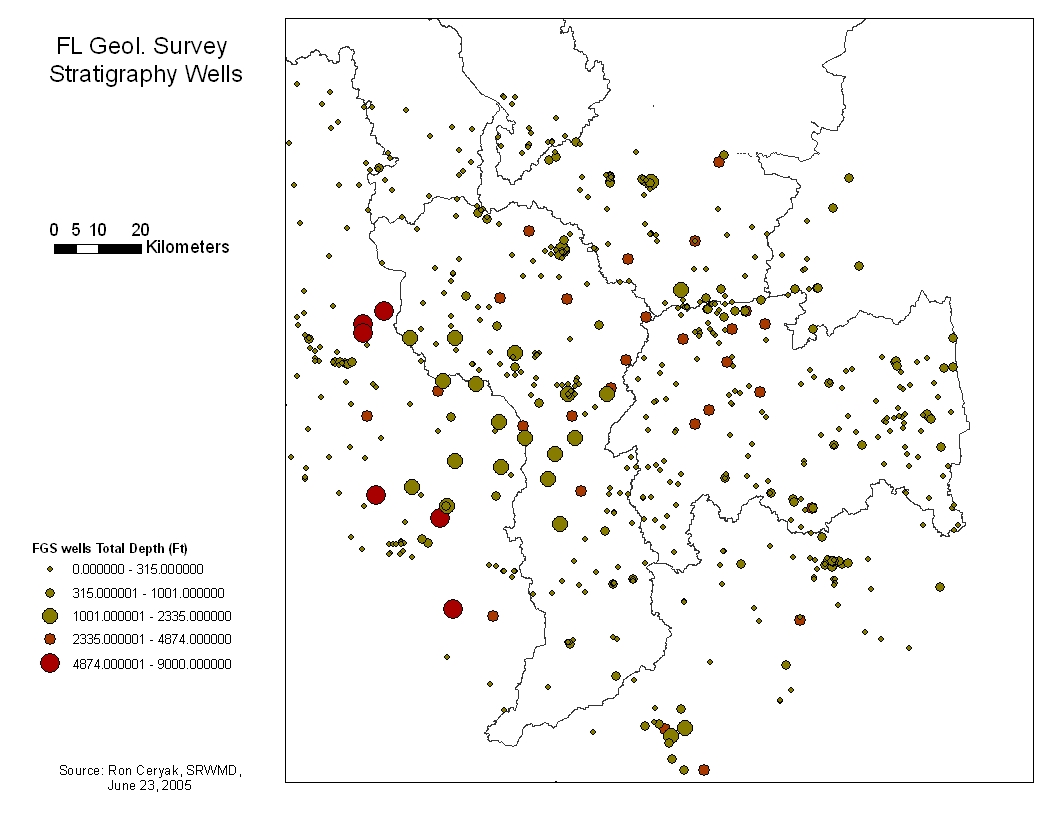
| Stratigraphy wells | from Florida Geologic Survey; locations surveyed by SRWMD (R. Ceryak). |
|||
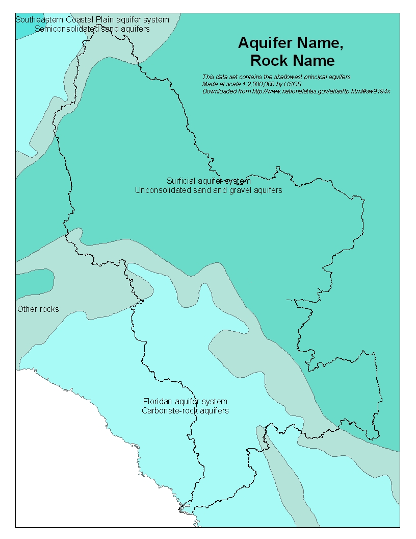
Aquifers (uppermost) |
|
|||
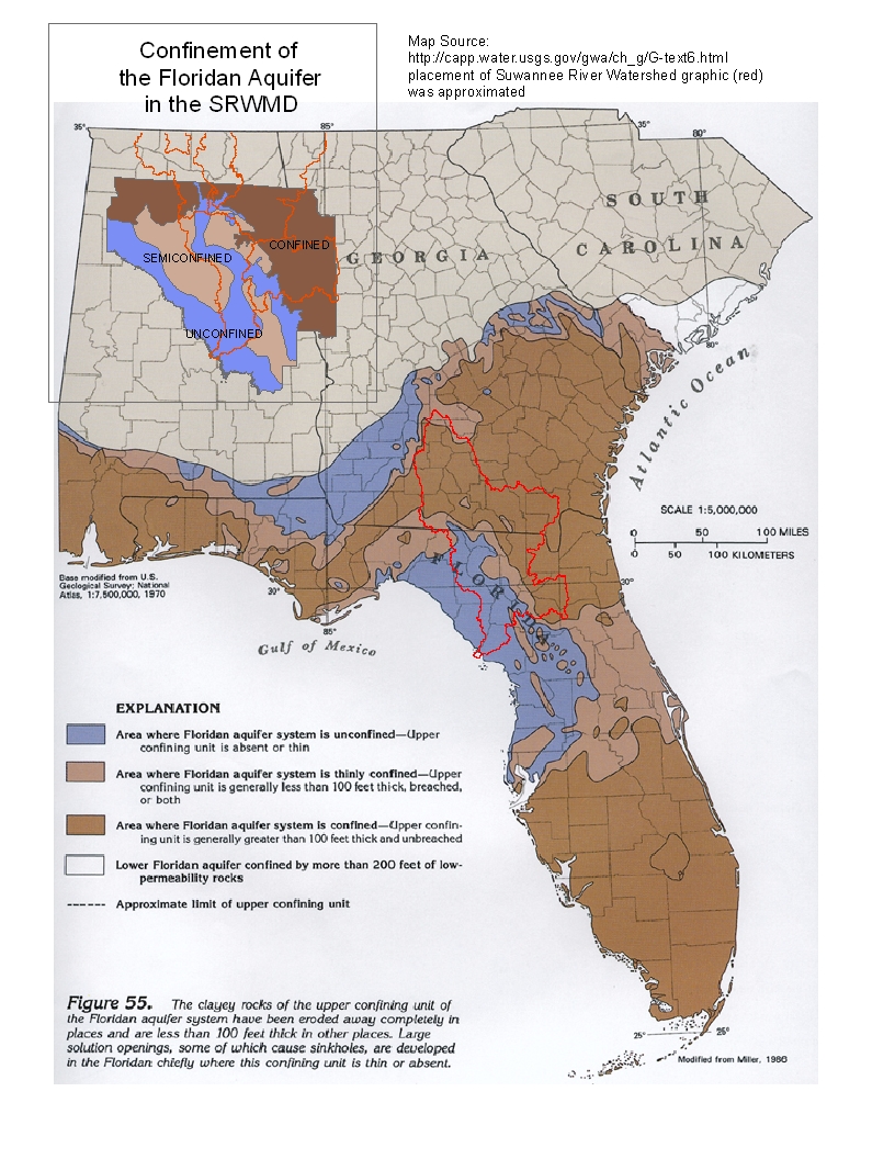
| Floridan Aquifer extent, (map not georefferenced) | showing confinement | Confinement of the Floridian Aquifer in the SRWMD (.jpg) |
|
|
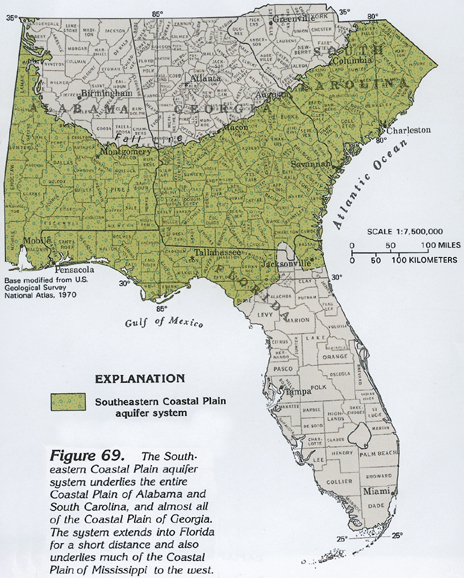
| SE Coastal Plain Aquifer extent (map not georefferenced) | South eastern Coastal Plan Aquifer (jpg) |
|
|
|
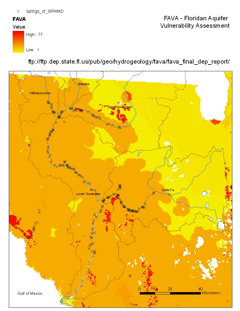
Groundwater vulnerability (FL) |
To predict the vulnerability of Florida’s major aquifer systems to contamination the Florida Geological Survey is developing the Florida Aquifer Vulnerability Assessment (FAVA) model. FAVA differs from the EPA’s DRASTIC model in that the newer technique accounts for karst terrain. |
FAVA - Floridan Aquifer Vulnerability Assessement (jpg) | Florida Geology forum newsletter 2002 (395KB pdf)
|
|
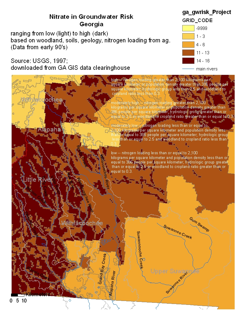
Groundwater vulnerability - nitrates (GA) |
Based on input factors and groundwater vulnerability factors. Four risk groups |
|
||
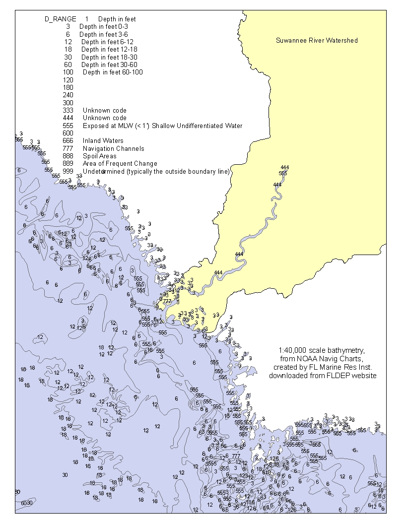
Bathymetry estuary |
|
|
||
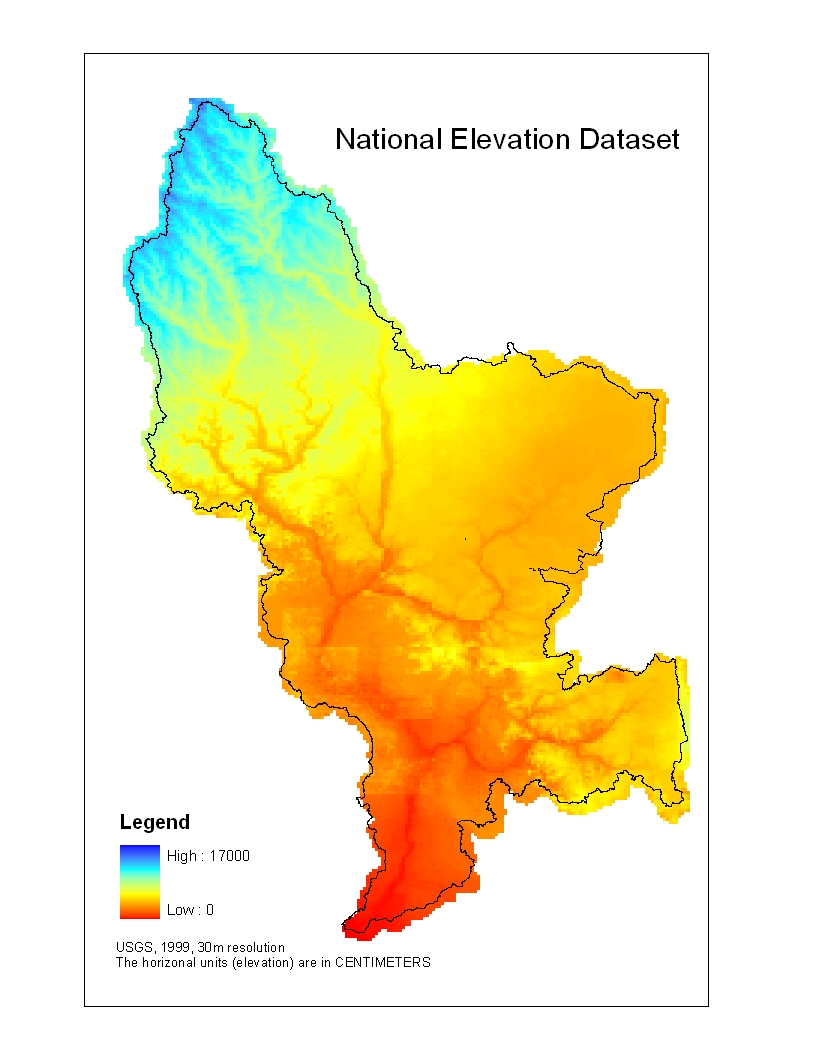
National Elevation Dataset (NED) |
|
|
||
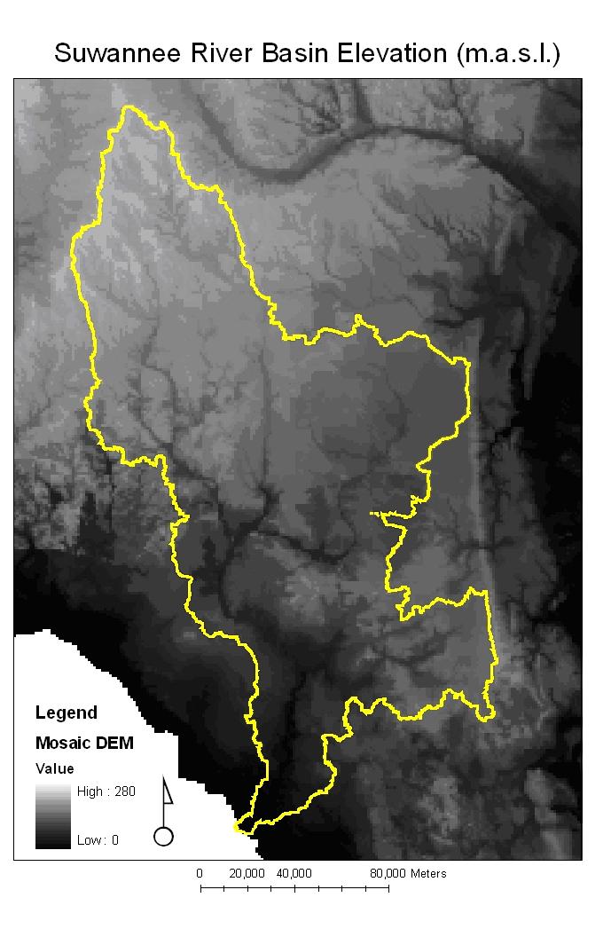
Digital Elevation Model (DEM) |
|
|
||
1:100,000 Soils |
SSURGO |
can be downloaded |
|
metadata |
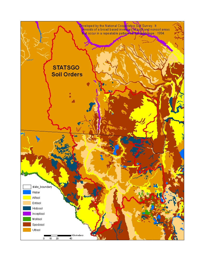
1:250,000 Soils |
STATSGO |
|
Human Impact
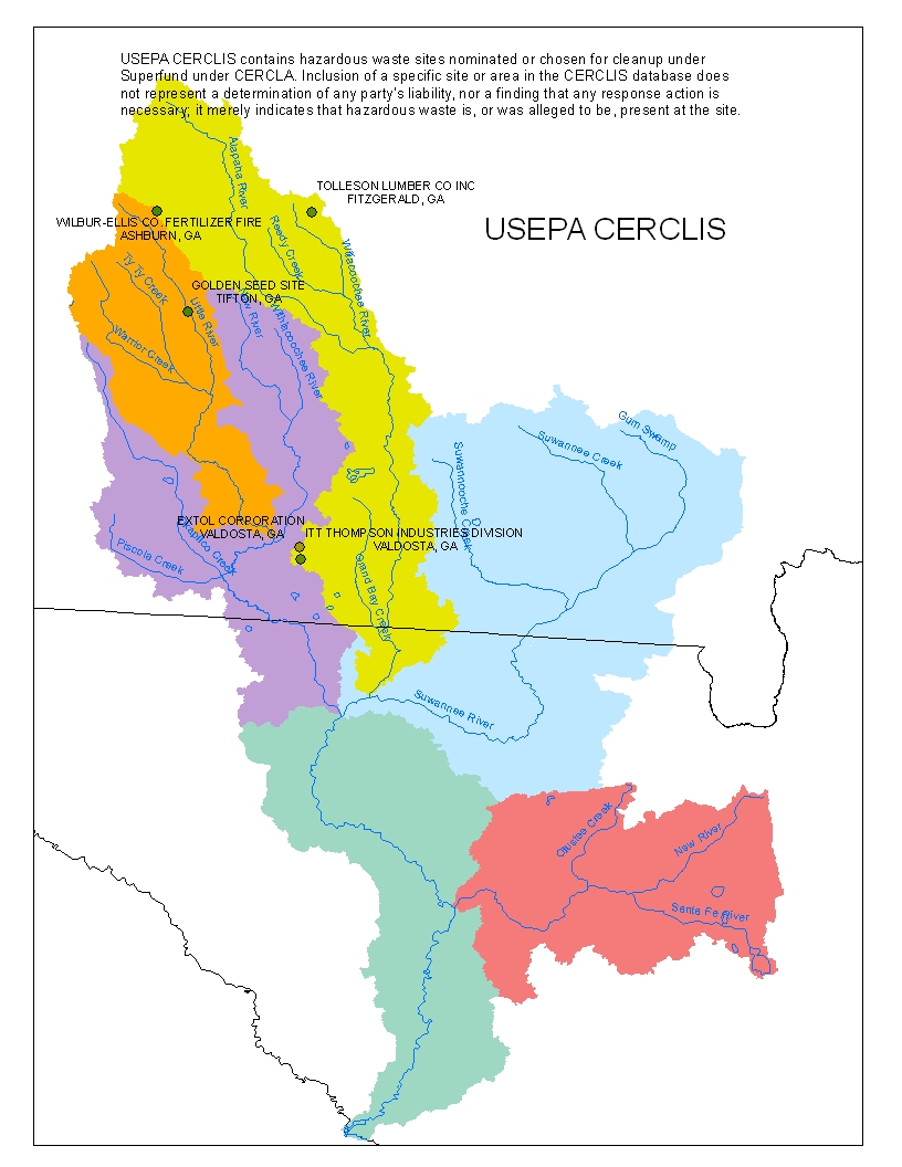
Superfund Priority sites |
||
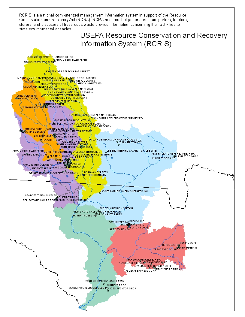
RCRA sites (EPA) |
generators, transporters, treaters, |
USEPA Resource Conservation and Recovery Information System (RCRIS) (jpg) |
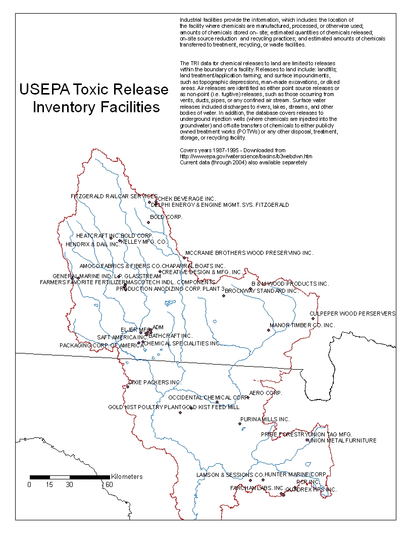
Toxic Release Inventory Facilities (EPA) |
||
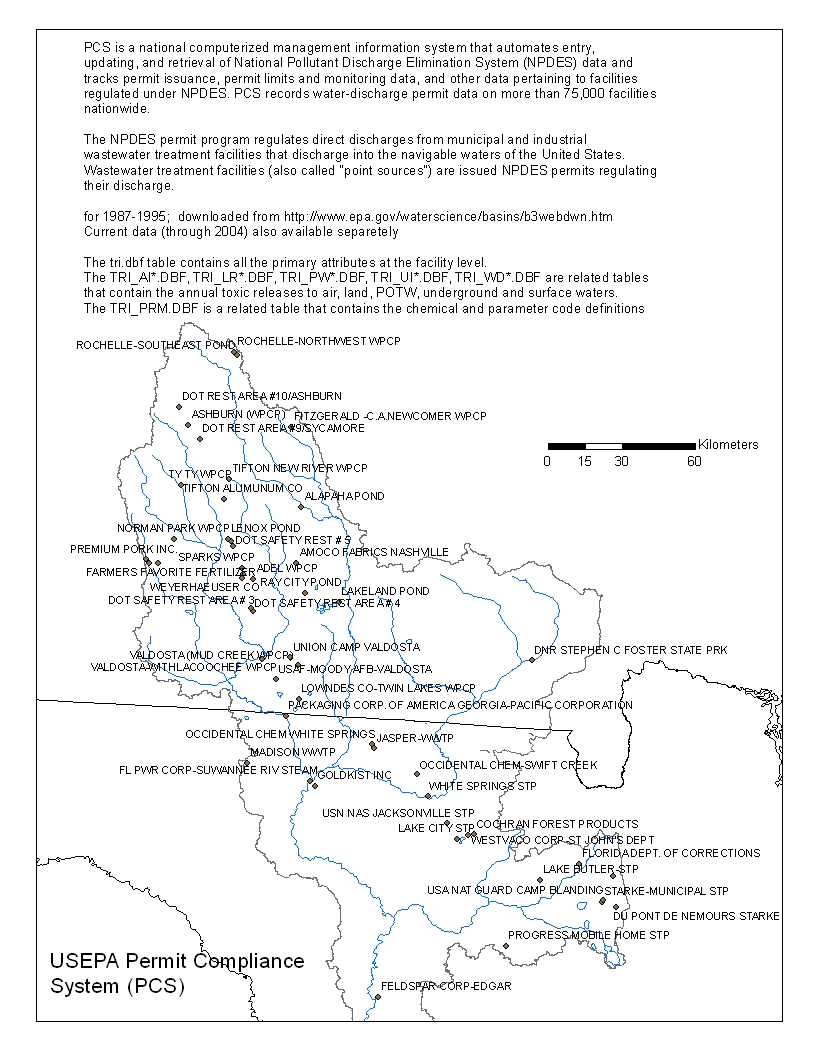
NPDES Permit Compliance (EPA) |
||
Landfills |
||
Night Lights |
||
Population |
US Census Bureau |
|
Population |
modeled with satellite |
Ecology
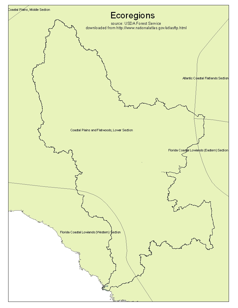
Forest Service Ecoregions |
|||
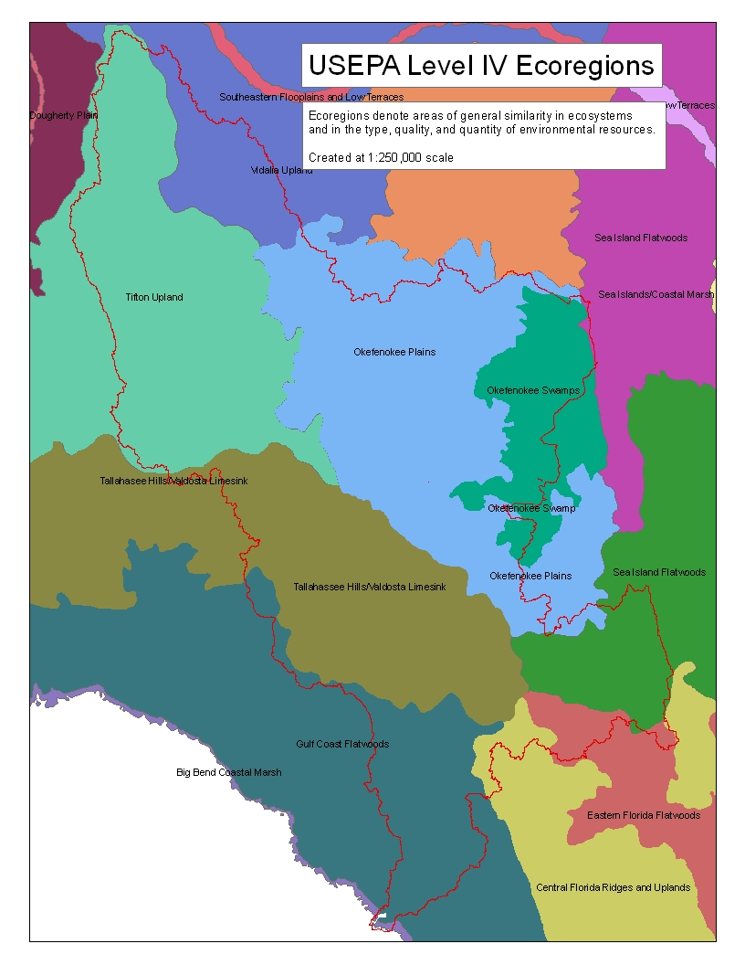
EPA Level IV Ecoregions |
metadata |
||
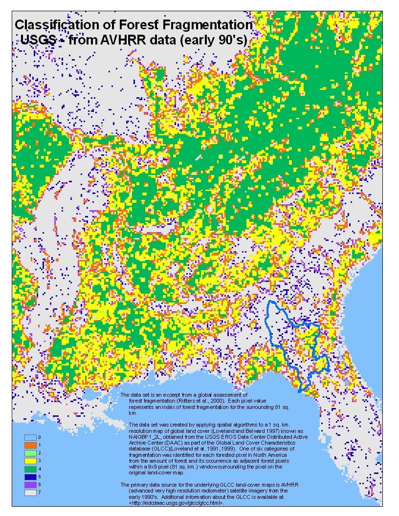
Forest Fragmentation |
Classification of Forest Fragmentation USGS from AVHRR data (early 90's) (jpg) |
||
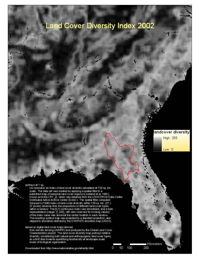
Land Cover Diversity Index |
1 sq. km resolution raster |
||
FNAI Habitat Conservation Priorties |
|||
FNAI The number of acres of forestland acquired that will serve to maintain natural groundwater recharge functions |
|||
FNAI Floodplains |